Quantcast


Lots of well-planned biking trails criss-cross Connecticut

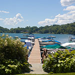
Almost all parts of Connecticut have formal biking trails that are well-maintained and rated for bicyclists of varying abilities. Renovation of old railroad tracks into bike-friendly rail trails is an ongoing project. Trails pass through and around cities and into the country side. A great place for bicycling is the state parks

ct biking
Vernon Rails-to-Trails

Manchester/Vernon Border to Hop River State Park Trail Manchester, CT Phone:

Trail Length: 4 miles

This pretty trail network overlooks ravines and streams. From the trail head on Church Street, the Vernon Rails-to-Trails Park offers three trail segments: the Hop River State Park Trail leads to the Manchester/Vernon town line; the Vernon section of the trail leads through thick woods to the Bolton town line; and the Rockville Spur reaches a bridge crossing the Tankerhoosen River.
Parking and Trail Access: The Vernon Rails-to-Trails Park is on Church Street between Phoenix and Washington streets.
Trail Activities: Biking walking, cross country skiing. Trail Map
Air Line Rail Trail -- South

Trail Length: 22.4 miles

Air Line Rail Trail follows the Air Line Railroad track, laid down in 1873. The south section of the trail stretches from East Hampton to Willimantic, with a link at its midpoint to a spur south to Colchester. (The northern section, from Windham to Putnam, is too rough for bicycles.) Round-trip bike riders should start in East Hampton. Over the next 3 miles, you'll cross the Rapallo and Lyman Viaducts. The onward trail soars over streams and the broad Blackledge River before crossing a causeway through Raymond Brook Marsh.
An eighth of a mile from a trailhead and large parking area on State Route 85, the 3-mile Colchester Spur Rail-Trail joins the main line. You'll cross Route 85 and eventually emerge at an undeveloped trailhead anchored by the old Colchester Railroad Station.
Quinebaug River Trail

The southern section of the trail follows the Quinebaug River just south of Route 6 in Danielson. The trail starts where Main Street (Route 12) intersects Route 6. The trail is paved and is suitable for bicycles, wheelchairs, or strollers.
The northern section is also a paved trail that is suitable for bicycles, wheelchairs, or strollers. The trail starts at the Holiday Inn just west of the Attawaugan/Ballouville exit of 395 (exit 94) and goes north along Tracy Road toward Putnam. The trail ends on Tracy Road, but if you continue north into Putnam you can connect with the Putnam River Trail along the Quinebaug River.
Trail Surfaces: Asphalt Trail Activities: Bicycling, walking
Windsor Locks Canal State Park Trail

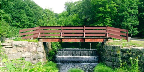
Canal Road in Suffield to Route 140 Mill Complex in Windsor Locks Suffield to Windsor Locks, CT Phone: 860-242-1158

Trail Length: 4.5 miles

The 4.5 mile Windsor Locks State Park Canal Trail follows the historic towpath of this 170- year-old historic waterway. The canal’s many vantage points offer the trail user scenic vistas of both the Connecticut River and the old canal.
Parking & Trail Access: To start at the Canal Road parking lot, take exit 47W off of I-91 and follow Route 190 West for 1.3 miles. Turn left onto Route 159 South and take the first left onto Canal Road and follow to the parking lot.
To start at the Route 140 Mill Complex parking lot, take exit 45 off of I-91 and go west on Route 140. Just after you cross over the Connecticut River there will be a Mill Complex on your right. Take the narrow road down along the canal to a parking lot. Seasonal Restrictions: The towpath is closed to all uses from mid-November until early April of each year. This is to protect the nesting habitat for endangered birds of prey.
Trail Surfaces: Asphalt
Trail Activities: Bike, fishing, walking
Derby Greenway

Division Street to Main Street Derby, CT Phone:

Trail Length: 1.7 miles

The trail, which is 1.7 miles long, runs atop the flood control walls on the Naugatuck and Housatonic Rivers and is tied together by the portion of the trail running on O'Sullivan's Island. The trail links Derby to Ansonia and Shelton and also links the six major bridges in Derby. One of the centerpieces of the trail is the spectacular new pedestrian footbridge.
Trail Surfaces: Asphalt
Trail Activities: Bike, inline skating, wheelchair accessible, walking
Housatonic Rail Trail in Trumbull (Pequannock Valley Greenway)

Tait Road to Old Mine Park Trumbull, CT Phone:

Trail Length: 3.4 miles

This fairly flat trail overlooks the winding Pequonnock River for 3.4 miles. The trail starts at Tait Road. As Route 25 crosses the railroad track, there is a short hill to Parlor Rock Park to the wooden bridge under Route 25. Through Old Mine Park, the trail parallels the park entry road. After Route 111, the trail splits. A new trail bears right and ends at the Victorinox property. From Victorinox, turn left and cross through the parking lot. Just after crossing a bridge, turn left to resume the trail.
Parking: To park near the old town hall, take State Route 25 to Exit 9 and turn south on Daniel's Farm Road. Take a right on State Route 127 and a right on Tait Road to the small parking area beside the old town hall. The trailhead is 50 yards down the road on the left.
Railroad Ramble

Route 41 and Main Street in Lakeville to Library Street in Salisbury Lakeville to Salisbury, CT Phone:

Trail Length: 1.7 miles

The Railroad Ramble occupies a corridor abandoned by the Central New England Railroad. In Lakeville, the trail can be found just off of Route 41 at the back edge of a recreational complex. The trail here is dirt and grass. The dirt and grass end at Walton Street, where the trail shares the street's asphalt surface for a couple of blocks. At the end of Walton Street, the trail surface is dirt and grass until it ends at Library Street in Salisbury.

Parking & Trail Access:
The Railroad Ramble parallels US Route 44 in Lakeville and Salisbury. Trail users can access the trail from the ballfield at Route 41 and Main Street across from the fire station or Walton Street in Lakeville, Salmon Kill Road in Salisbury or via Library Street and Railroad Street in Salisbury. 
Bike Trail - Stratton Brook State Park - Simsbury, CT
Stratton Brook State Park Trail

Stratton Brook State Park Simsbury, CT, 06070 Phone:

Trail Length: 2 miles

This 2-mile trail has a covered bridge at its midpoint. From the covered bridge, the shaded rail trail shoots northeast and southwest along an old railroad bed. After bridging Stratton Brook and rounding a bend, the trail leaves the park, ending at the Bushy Hill Road and State Route 309. You can get onto the canal trail by turning right on State Route 309 and following the shoulder a half mile. For a slightly longer ride or walk, turn southwest from the covered bridge and cross Stratton Brook Road. From there, the old railroad grade is a paved road for 1.7 miles, where it enters Massacoe State Forest.
Trail Surfaces:Asphalt, crushed stone, cinder
Trail Activities: Bike, wheelchair accessible, mountain biking, walking, cross country skiing
Charter Oak Greenway

Trail Length: 9.8 miles

The Charter Oak Greenway is a paved, multi-use trail connecting parks and neighborhoods in East Hartford. The trail runs for 9.8 miles from Forbes Street in East Hartford to Bolton, including a section using local roads. The trail provides seasonal access to restrooms, picnic areas, tennis courts, and a playground at Charter Oak Park. Bike lockers are at Route 83 and Charter Oak Street and at the Spencer Street commuter lot. Some hills are quite steep.
Parking and Trail Access: From I-384 eastbound, take exit 3 (Route 83). Turn right onto Route 83 North. Turn right at light onto Charter Oak Street. Turn right at light into Charter Oak Field. From I-384 westbound, take exit 3. Turn right at end of ramp onto Charter Oak Street. As above.
Farmington Canal Heritage Trail

Trail Length: 40 miles

Running north from the Yale University campus in New Haven through the heart of Connecticut, the Farmington Canal Heritage Trail comprises several distinct segments totaling 40 miles of rail-trail. The trail follows the corridor of the defunct Farmington Canal. Segments are the New Haven section, Hamden to Cheshire section, Southington section, Farmington to the Massachusetts border section. See trail website for detailed directions.
Farmington River Trail

Farmington River Trail offers an 8.5-mile excursion along the Farmington River. The southern trail head at Tunxis Mead Park in Farmington also serves as a trail head for the Farmington Canal Heritage Trail. Follow signs to the river trail. Two miles in, the trail follows a quarter-mile road. Cross Route 177 at the crosswalk and head straight on Railroad Avenue.
At the road's end, continue straight on the dirt path and cross River Road. The trail parallels the river and Route 4. The trail follows an old road and passes and old dam. At 7.5 miles, a ramp climbs to a restored train bridge. Good for biking , skating, fishing, walking, cross country skiing. - Trail Map
Middlebury Greenway

Junction of Routes 64 and 63 to Quassy Amusement Park Middlebury, CT Phone:

Trail Length: 4.4 miles

This asphalt path winds 4.4 miles through Middlebury. State Route 64 parallels the greenway for its entire length, but this won't lessen your enjoyment. The trail follows the contours of the land, making it hillier than a typical rail trail. If you're taking the trail out and back, travel east to west for an easier downhill return. Parking on the east end is also more convenient. The initial stretch is an in-town trail. Farther west you'll come upon two small landscaped parks. Alternating between woods and residential areas, the trail continues 2 miles to Meadowview Park. Approaching the trail's west end, you'll overlook Lake Quassapaug and its sandy beach, and pass Quassy Amusement Park. The trail ends at an access road leading to a Little League baseball field.
Putnam River Trail

Providence Street to Arch Street Putnam, CT Phone:

Trail Length: 2 miles

This 2-mile biking and walking trail begins at Arch Street and winds its way north along the eastern shore of the Quinebaug River. The trail runs adjacent to Kennedy Drive for about 2 miles before terminating at Providence Street. The path of the trail runs through woodlands, two parks, an antique shopping district, and near revitalized mills. Five historic exhibits are located along the trail commemorating Putnam’s railroad history, textile mills, and founding citizens. There are three bridges adjacent to the trail including a 200-foot pedestrian bridge. Each bridge offers scenic views of the river.
Trail Surfaces: Asphalt Trail Activities: Bike, walking